Distribution of Generic Watercourse Terms
Below are some interesting maps showing how generic terms for watercourses are distributed in the Northeastern United States from a 1955 paper by Wilbur Zelinsky.1 The term river is universal throughout the examined area, so only terms applied to small- and mid-sized streams were examined.
The term creek was typically used in England only for coastal estuaries of which there are of course many along the Atlantic seaboard of America; however, it’s American usage as a generic term for fresh water streams occurs most commonly west of the Hudson River:
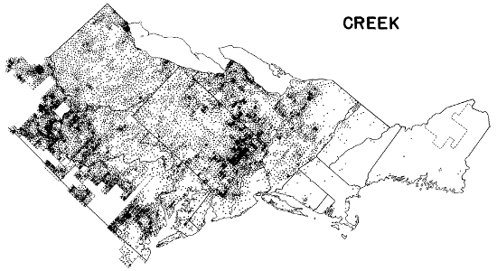
Zelinsky discusses the theory that because of the broader coastal plain in this area, coastal watercourses named as creeks actually flowed from much farther inland. The term was applied more generally as the population expanded to the interior.
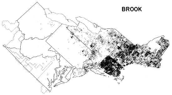
The term brook is coincident with the New England cultural area and it’s expansion directly westward. It’s English meaning as a stream with a fast flow rate was more applicable to the hillier coastal topography.
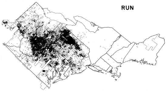
The term run is dialectical to northern England and Scotland and may have become common in the Appalachian area because of the influx of Scottish and Irish immigrants.
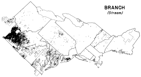
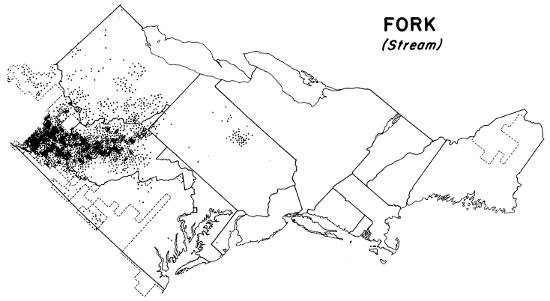
Both branch and fork were used exclusively to describe tributaries in England, but were applied to general streams in America. Although the terms were used widely, no pattern can be discern from their application other than the fact that they are entirely absent from the earliest areas of settlement, indicating a later adoption.
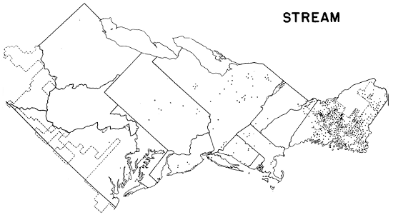
The generic term stream is only common in the most northerly reaches (and most lately settled) areas of New England, and also very sporadically south to Virginia.
·
1 Some Problems in the Distribution of Generic Terms in the Place-Names of the Northeastern United States by Wilbur Zelinsky. Annals of the Association of American Geographers, Vol. 45, No. 4 (Dec., 1955), pp. 319-349. back.

About 10 years ago I was playing around with the USGS Gazetteer and produced a slightly different set of maps (covering slightly larger territory) that might be of interest to those who appreciate toponymy and Zelinski’s wonderful insight. Take a look at http://oook.info/giswork/hollows.html for the tale as I told it then.
» Posted by Hugh Blackmer on January 18, 2010 09:23 PM