
Old Burlington Mall
Off in a corner of a parking lot of the Executive Office Park in Burlington, Massachusetts there is a small waterfall where a little stream emerges out from under Mall Road and tumbles into what, for all intents and purposes, is a drainage ditch.1 It’s a bit remarkable that in the otherwise dehumanizing surroundings of a typical suburban industrial park there remains this small remnant of relatively untouched landscape— such as it is.
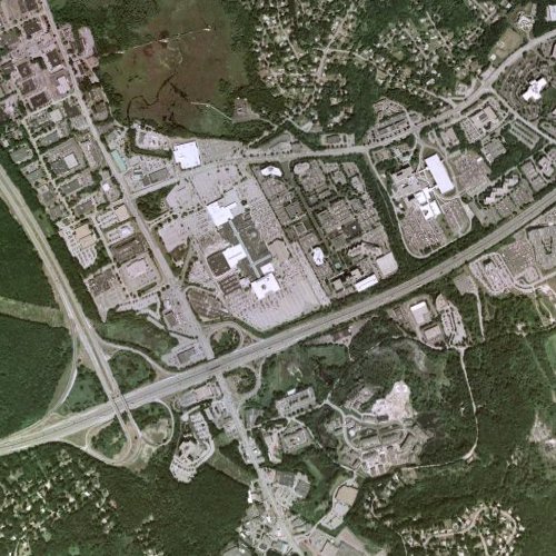
Site of the Burlington Mall; Burlington, MA.
My father talks about hunting in the area as a kid, of course long before the Burlington Mall and Route 128 were put in, when this area was what he thought of as the middle of nowhere. Burlington is currently a modestly sized suburb of Boston with a population of around 23,000, but back before it was tied into the national highway system, it hovered around 1000.
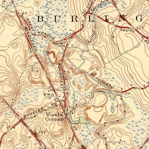
Site of the Burlington Mall; Burlington, MA, 1946 prior to the construction of Route 128.
Looking at some old USGS maps of the area shows just how much things of changed. The Vine Brook has been completely covered by the mall itself - and emerges out on the other side of the Vine Brook Plaza - another bit of development named in typical fashion after the very thing it has helped destroy… The waterfall is part of the Long Meadow Brook—which has more or less maintained its original course, although straightened along the edge of the parking lot before passing back under the road where it eventually joins with the Vine Brook before merging with the Shawsheen River.
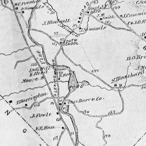
Site of the Burlington Mall; Burlington, MA, c. 1870.
When 128 and the Mall were put in, a number of streets where reconfigured, including the location of the old South School at the junction of Blanchard Road and Lexington Street.
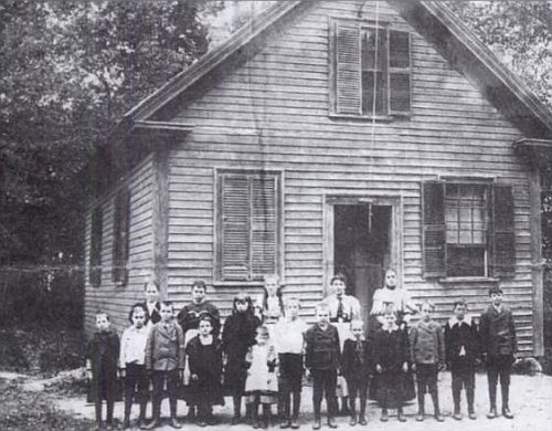
South School in Burlington, MA. Now a parking lot outside of Sears.
The only picture shows the old building in a verdant, rural setting—basically the antithesis of what is now there: the parking lot of the Sears Home and Garden Center.
1 Here is a picture of the falls itself. The flow is unusually high here because of recent rains.
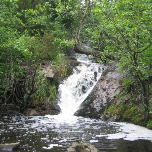
Long Meadow Brook Falls.
A file, viewable in Google Earth, showing the maps above laid out over the modern terrain is available here.
A map showing the precise location of the falls is here. In the satellite view, the arc of the brook can be easily made out even though it is obscured by vegetation.
A short video clip that captures some of the majesty of the falls is here.