
New Maps of Pluto
The “New Horizons” probe recently passed the half-way point to Pluto - at least in terms of total distance flown. According to this simulation, it will be half-way between Pluto and the Sun on July 14th, and then half-way in terms of total mission time on October 16th. It’s traveling around 59,000 km/hr relative to the Sun and still won’t reach Pluto until July 14th, 2015 (at 07:59:00 GMT, so set your watches.)
Marc Buie of the Southwest Research Institute recently unveiled the highest resolution maps of Pluto yet produced:
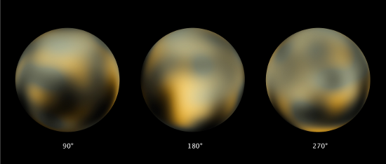
Simulated true-color spherical projections of Pluto
This video shows a single complete rotation:
These maps and how they were produced are outlined in two recently published papers (one, two). Some of the raw images used to produce the maps captured by the Hubble telescope are shown below. The ones furthest to the left were obtained by the Faint Object Camera (FOC) in 1994; this camera is now out of service and has been replaced by the High Resolution Camera (HRC) which (despite its name) produces slightly lower resolution images (as can be seen below). Faster computers have allowed a reanalysis of the original images and a comparison to be made with maps produced from the analysis of the newly acquired ones.
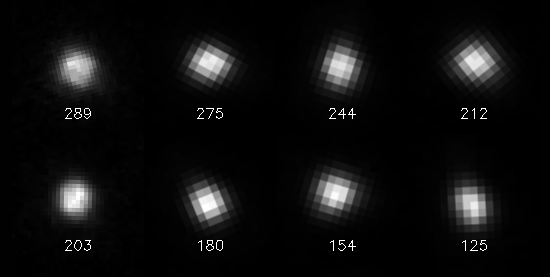
Raw Hubble images captured in 1994 (left-most column) and 2002/3
Similar processing techniques were applied to images taken in 1994. Compared to the latest data, these show what Buie calls a “complex and dynamically interacting surface–atmosphere system.”
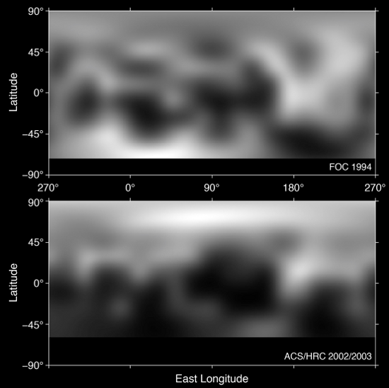
Maps showing surface changes between 1994 (top) and 2002/3 (bottom)
It has long been known that Pluto has a thin atmosphere which gradually freezes and thaws as it moves closer to and further from the Sun over its 248-year orbit. These maps though show direct evidence of this effect.